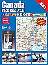
The Canada Back Road Atlas contains full coverage of
Canada from the urban and rural south to the vast nort and from sea to shining
sea. Accurate and up-to-date maps that can help you find your way around
cottage country, plan a vacation or discover the fastest route to your next
destination.
Features:
- Maps of Southern Ontario, Southern Quebec, Maritimes,
Southern BC and Alberta at 1:250,000 scale and less populated areas at
1:500,000.
- Vacation planning and reference points of interest including
tourist locations, campgrounds, provincial parks, conservation areas, picnic
areas, ski areas, tourist information, airport locations, ferry routes, border
crossings, distance charts and many more.
- Comprehensive index of cities and towns including a separate
index for country roads, rural roads, concession roads, grid roads, secondary
highways and major highways.
|
|