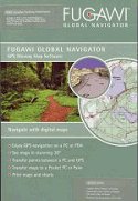
Fugawi Global Navigator is the ideal PC software tool for
route planning, GPS programming, and real-time GPS navigation on land, sea and
in the air.
With Fugawi Global Navigator you can navigate in real
time using the widest variety of digital maps, such as BSB V. 4, topographic
maps, Garmin IMG format maps, Fugawi Street Maps, or with your own scanned
paper maps!
Fugawi Global Navigator also brings you the
convenience of planning routes, waypoints and tracks on your maps. With a click
of your mouse they can be uploaded into your GPS receiver or chartplotter for
use in the field. Also, routes, waypoints and tracks created on your adventures
can be downloaded from your GPS onto the digital map(s) in Fugawi for
analysis.
Also enjoy the seamless integration with optional Fugawi iMap
for iPhone, iNavX for iPhone or PathAway GPS Software for Windows Mobile
smartphones.
Whether cruising the open ocean, fishing your favorite
lake, or hiking a new trail, use Fugawi Global Navigator to plan your
adventure and find your way. Import your favorite map to explore terrain; view
stunning 3D landscapes; mark your routes; program your GPS; or discover
Geocaching locations with a simple click on the map.
- Shows your track and current location on the screen
- Full navigational features: speed, waypoints, routes,
distance to go, course to steer, magnetic and true courses
- Supports Canadian Topo maps on CD and DVD, Garmin IMG format
maps (not Bluechart), Softchart charts (NOS/GEO), USGS DRG Topo Maps, and U.S.
and Canadian nautical BSB charts
- Navigate with maps from a wide variety of sources, including
CD, DVD and scanned paper maps
- Built-in Odometers and Trip Odometers to calculate distance
traveled
- Choose from imperial, metric, or nautical display units
- Plot points and read coordinates from maps with exceptional
precision
- Geographic Name lookup. Look up a name and click to autoload
a map
- Fugawi automatically loads the appropriate map from your
digital library as you travel
- Exports waypoints and tracks with UTM coordinates or
latitude/longitude
- Scan paper maps or charts - Fugawi accurately calibrates any
scanned map and turns your paper map into a Moving Map Navigation System
- Fugawi corrects scanned maps for rotation, skewing and
differential stretching of the axes caused by photocopying or paper
shrinkage
- Please Note: the maps or
charts will not appear on the screen of your GPS
Includes a Bonus Data Pack on DVD including detailed street
maps of Canada, as well as elevation data and place names
data.
Advanced Features:
- Easily move to an adjacent larger or smaller scale map with a
click
- Make a trail map by printing your waypoints, routes and/or
tracks on your map
- Display the elevation profile for a track or route
- Make multiple tracks and routes visible
- Night and Dusk vision display
- Attach sound and pictures to waypoints and automatically play
them as you approach
- Synchronize the computer clock to the GPS clock
- Determine Sunrise and Sunset for any location and date
- Import NMEA log files
- Create User Grids in Transverse Mercator projection
- Supports ESRI Shapefile (.SHP) format export of Waypoints,
Routes and Tracks
- Supports Google Earth KML files for import/export of
Waypoints, Routes and Tracks
- Supports Google KMZ files for import/export of Waypoints,
Routes and Tracks (and Photo Waypoints)
- Support for optional (and free) Fugawi Google Earth
Plug-in
- Unlocked Garmin IMG maps may be uploaded to a Garmin mapping
GPS receiver
3D Viewing Feature:
- View your favorite chart or map in stunning 3D.
‘Fly’ across the 3D landscape using your mouse, keyboard, or
joystick, or view your GPS position in real-time on the 3D chart. A great tool
for finding the perfect hiking route.
You can navigate with confidence using the software - it helps
plot your route, obtain precise coordinates - it even loads the appropriate map
from your digital library as you travel!
Digital Map
Requirements:
- Scanned map or raster map file in JPG, BMP, GIF, PNG, PCX or
TIF file format; you must know the map datum and co-ordinates for 3 points on
the map
- BSB Marine Charts
- DRG topographic maps from USGS
- ChartTiff Products
- All Maptech chart products
- Fugawi digital maps in BSB format
- Geocache sites from the internet by clicking on a map in
Fugawi
System Requirements:
- 500 Mhz processor or better
- Windows 7, Vista or XP
- 512 MB RAM
- 250 MB on your hard drive
- 256 colour (or more) display
- Mouse or other pointing device
- USB or Serial port for GPS receiver (Serial to USB Adaptor
may be required, depending on GPS model).
- DVD drive
- Program provided on CD
- Included Fugawi PDA Edition supports Pocket PC 2003, Windows
Mobile 5 and Palm OS V5.x
- Software package does not contain GPS, cable, or handheld
computer
GPS Receiver Requirements:
- GPS receiver with NMEA 0183 output or compatible USB GPS
- Supports waypoint, route, and track transfer with most
Garmin®, Magellan®, Lowrance®, Humminbird, Silva/Brunton, Furuno,
Raymarine, GEONAV and other models
- Supports route transfer with the Suunto X9 and X9i GPS
wristwatches
- Supports real-time navigation with above models plus any GPS
with NMEA V2.1 or greater output. (Serial to USB Adaptor may be required.)
- Note: Fugawi Global Navigator can be used without GPS to plot
and export positions to a text file, view maps and charts, and much more
All purchases of software are final. More information can be
found in our Return Policy.
|
|

